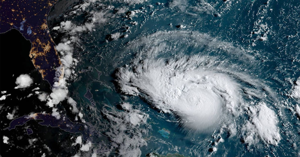

Hurricane season ended on November 30, but not before Hurricane Dorian had decimated the Bahamas, taking lives and setting their infrastructure and economy back, potentially for years. On U.S. soil, Hurricane Barry and Tropical Storm Imelda had flooded Texas and the Carolinas, leaving billions in damage.
All told, Hurricane Season 2019 storms were stronger, more rapidly intensifying, slower-moving, and dumped a lot of rain. And this trend may continue if no action is taken to combat climate change.
The Tropical Weather Summary for the 2019 Atlantic hurricane season was released on December 1. Tropical cyclone activity this year was above normal with 18 named storms, 6 hurricanes, and 3 major hurricanes. The long-term average Atlantic hurricane season has 12 named storms, 6 hurricanes, with 3 of those hurricanes becoming a major hurricane, Category 3 or higher. NOAA’s original hurricane outlook from May had called for a 30% chance of that happening, with a higher chance of the season being near normal. However, the updated forecast from August raised that probability to 45%–closer to the actual outcome.

2019 is the fourth season in a row with above-normal activity:
| Named Storms | Hurricanes | Major Hurricanes | Highlights | |
| 2019 | 18 | 6 | 3 | Dorian’s strength and the amount of rain brought by stalling storms Barry, Dorian, Imelda, Fernand |
| 2018 | 15 | 8 | 2 | Florence’s record-setting rains in the Carolinas, Michael is the strongest hurricane to hit the Florida panhandle |
| 2017 | 17 | 10 | 6 | Harvey and Irma are first major hurricanes to hit US mainland in 12 years, Maria’s devastation in the Caribbean |
| 2016 | 15 | 7 | 4 | Matthew is first Category 5 hurricane to form in the Atlantic since 2007 and the most damaging of the season |
What was “new” in 2019?
In addition to being above normal, this season brought with it several records and interesting firsts. Let’s take a look at what stood out about the 2019 hurricane season.
- 2019 was the fifth consecutive year that a named storm formed before the official season start.
- In mid-September, six named storms were active at once in the Atlantic and Pacific, a number believed to tie a National Hurricane Center 1992 record.
- 2019 was the seventh season with more than one Category 5 storm since records began in 1851.
- 2019 saw the strongest and easternmost Category 5 storm in the Atlantic, Hurricane Lorenzo. Lorenzo intensified very fast and became a Category 5 in the middle of the North Atlantic, an area where, in addition to waters being too cold, wind shear usually prevents their formation. However, this was not the case when Lorenzo picked up speed.
- Late-forming hurricane Pablo became the easternmost and second northernmost storm in the Atlantic. Usually, those areas don’t see hurricanes because sea surface water is not warm enough–or didn’t use to be. Despite temperatures not being warm like those further South and well below the usual range for hurricane formation, the water was running about 1°C above normal when Pablo formed.
According to Scientific American, 2019 could be a taste of what the future will bring under climate change. Hurricanes like Dorian, which at landfall had sustained winds of 185 mph and gusts up to 220 mph, could become more common. It would be a Category 6 if there was one.
Another feature of 2019’s storms that could become more common was their slow speed, which brought heavy rain and damage: Barry, Dorian, Imelda, and Fernand moved at 8 mph or slower for two or more days near the time of landfall; the average forward speed of a tropical cyclone is about 11 mph.
Slow-moving storms have the potential to dump massive amounts of rain on concentrated areas. In fact, Barry brought the most rain ever recorded from a tropical cyclone to Arkansas and Tropical Storm Imelda (crawling at 5mph) became the seventh-wettest tropical cyclone on record in the United States. The four storms totaled more than $7 billion in damage

Are hurricanes becoming stronger?
In 2018, several scientists said that “observational data support the expectation from models that the strongest storms are getting stronger,” and the fact that the strongest storms in terms of wind speed have been recorded in recent years is exemplary of this trend. Moreover, a recent study found that hurricanes have become more destructive since 1900, with the worst of them being more than 3 times as frequent now than 100 years ago. The authors attribute the increase in destructiveness to “a detectable change in extreme storms due to global warming.”
The contribution of human-caused warming to these trends is getting ever clearer. Another recent study found no influence of anthropogenic global warming on the frequency of tropical storms, but found that the proportion of Category 4 and 5 hurricanes has increased at a rate of approximately 25 percent to 30 percent per °C of global warming. The authors suggest that a level of increase may be reached where any further global warming will have little effect–not the case for now.

Are hurricanes intensifying faster?
The National Hurricane Center defines rapid intensification as “An increase in the maximum sustained winds of a tropical cyclone of at least 30 knots (34.5 miles) in a 24-h period.” In the past few hurricane seasons, we have heard of storms intensifying really quickly, such as Harvey and Michael. This year, Lorenzo did the same. Is that a trend?
A February 2019 study found that the rapid intensification rates observed in Atlantic hurricanes in recent years do not align with what we’d expect from natural variability alone. Data from 1982 to 2009 showed that the percentage of Atlantic storms that rapidly intensified had increased significantly. The authors further stated that those higher intensification rates would likely have a positive contribution from anthropogenic warming.
Are hurricanes moving more slowly?
As mentioned before, 2019 had four storms that moved below the average forward speed of a tropical cyclone. Previous years also saw storms like that (Florence, Harvey), moving slowly or stalling over a region, bringing an immense amount of rain. According to Scientific American, there are no cases in the past century where an Atlantic Category 5 hurricane has stayed in an area as long as Dorian did in the Bahamas.
The forward speed (or moving speed) of a tropical cyclone bears no relation to the wind speeds within the cyclone itself, and have more to do with external, steering wind currents and atmospheric conditions, which will influence its movement and track. Scientists believe that the reduced difference in average temperature between the equator and the polar region may be behind the slower speed. Winds are a result of temperature differences–-air moving between different masses due to temperature differences, and the bigger the difference the faster the wind.
Because the Arctic has been warming at a much faster pace than other regions of the globe, the resulting winds are slowing down. That may be behind the slowing and stalling of tropical cyclones observed in the past few years.
A 2018 study found that the increase in stalling tropical cyclones is a global trend, and another one from 2019 from NOAA and NASA scientists found that, over the 1944-2017 period, the annual mean coastal North Atlantic tropical cyclone speed dropped from 11.5 mph to 9.6 mph, a slowing of about 17%. They also found that the stalling of tropical cyclones results in more rain for a region.
Although the authors, “make no attribution to anthropogenic climate forcing for the stalling or rainfall,” in an interview one of the authors stated that “[…] given that tropical cyclones are somewhat passively carried along in these winds, a reasonable hypothesis is that they are slowing down with warming. This is fairly compelling evidence for a human fingerprint on the slowing we’re observing.”
Are hurricanes dumping more rain?
In the past 3 years, five state records were broken for tropical cyclone rainfall: Barry in Arkansas, Florence in the Carolinas, Lane in Hawaii, and Harvey in Texas. A total of twelve states have broken their tropical cyclone precipitation records since 2000
In addition to the finding mentioned above that the stalling of tropical cyclones brings more rain, several other studies have explored the apparent trend of hurricanes bringing more rain with them in recent years.
The World Weather Attribution found that “the extreme rainfall and flooding caused by Tropical Storm Imelda was made more likely and intense due to global warming” and that “two-day extreme precipitation events along the Gulf Coast as intense as observed on 19–20 September 2019 or higher have become 1.6 to 2.6 times more likely due to anthropogenic climate change, or 9% to 17% more intense.”
And a 2018 study on anthropogenic influence on tropical cyclones found that, “relative to pre-industrial conditions, climate change so far has enhanced the average and extreme rainfall of Hurricanes Katrina, Irma and Maria…” They also conclude that, in future climates with more global warming, the wind speed and rainfall of 11 out of 13 intense tropical cyclones (of 15 events sampled globally) would increase.
In an August 2016 blog about extreme precipitation, I mentioned the fact that in the previous 17 months at the time, 8 rain events occurred whose rain totals were considered very low probability (i.e., less than 0.2%). Three of those eight had happened just in the previous 3 months.
Looking at that same list of significant events for which observed precipitation amounts for at least one duration (3 hours, 24 hours, 2 days, etc.) have low probability of happening, something else jumps out: In August 2016, out of all the 21 events then listed (others were added since), only one was related to a tropical cyclone (tropical storm Debby in 2012). All others were rain events not associated with tropical cyclones.
But when one looks at the 11 events added since then, 6 are related to tropical cyclones. In other words, more than 50% of new extreme precipitation events in the past three years with an exceedingly rare amount of rain have come from tropical storms or hurricanes. Even though there are no studies evaluating if this is a significant trend, if it doesn’t give you pause, I don’t know what would.
The future of hurricanes
Hurricane Season 2019, in summary, had stronger, rapidly-intensifying, slower-moving, and more rain-dumping storms. Those are trends that have been demonstrated. If this is a sign of things to come, we have a dangerous future to look into.
In order to avoid the worst impacts from climate change, we must drastically reduce fossil fuel consumption, invest in clean, renewable energy, and work on policies to go along with those changes so that nobody is left behind and all have a chance at a new, sustainable future. As the climate crisis becomes ever more apparent, there is no better moment to pledge all our efforts to ensure a better, healthy planet. We need more action and less talk.