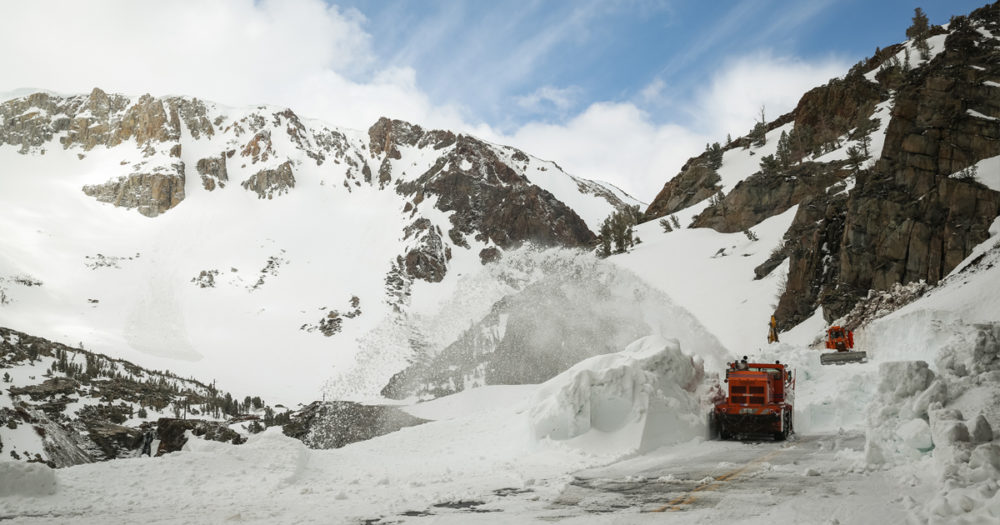

Everyone coming from or heading to spring break ski trips in the Sierra Nevada this year knows that California’s snowpack is having a great year. The Squaw Valley Alpine Ski Resort broke its record for the snowiest month this February at more than 300 inches. When the Department of Water Resources does its April snow survey next week they’re sure to get a stellar reading on the state’s water supply. If you remember the bone-dry April snow survey of four years ago, when Governor Jerry Brown declared a water emergency and historic statewide mandatory restrictions, it seems almost like we’re in a different state.
Despite the abundant water year we’ve had, though, over the long term climate change is transforming our snowpack and will make no-snow snow surveys more common in the future.
Not only is climate change making good snow years like this one less likely, it’s also changing what good snow years mean for our water resources. And that’s going to mean a very different April snow survey in the future.
Good snow years are becoming less likely
Climate change has a bleak future in store for California’s snowpack. As the atmosphere warms, more wintertime precipitation is coming to the state in the form of rain rather than snow. And that means less of that precipitation is being stored in the natural reservoir of our snowpack and more of it is becoming runoff that must be captured in surface or groundwater reservoirs if we hope to use it later. The warmer atmosphere also accelerates melting of the snow that does accumulate. And as more snow melts more dark, rocky mountainside is revealed, allowing more sunlight to be absorbed. This has created a vicious cycle of snow loss in the Sierra Nevada.
Since 1915, the western U.S. snowpack has declined by 21% – an amount equivalent to losing the entire capacity of Lake Mead. Studies show that depending on how aggressively the world moves to reduce greenhouse gas emissions, the Sierra Nevada could lose another 30-64% of its springtime snowpack by the end of the century.
When good snow years happen, they’ll be harder to manage
California’s current water management system is calibrated to a precarious seasonal cycle of supply and demand. California typically receives more than half of its yearly precipitation in just 15 days, mostly in the form of winter storms. Snowpack has historically helped build inertia into the system, storing water from winter storms and releasing it slowly into the dry summer months. But climate change is making the release of snowmelt more complicated to manage. Earlier springtime snowmelt and increased risks of extreme snowmelt runoff are making it harder for water managers to ensure that our reservoirs don’t end up with either too much snowmelt when we can’t use it, or too little snowmelt left when we need it.
Because of the relatively cool winter we’ve been having this year (and by that I mean cool relative to the record-breaking warm winters of 2014, 2015, and 2017, though still slightly above average), we’ve had more snowpack build up at lower elevations. That’s good news for water management because snowpack distributed across a wider range of elevation bands will melt more gradually as spring moves its way up the mountainside. However, as climate change increases temperatures and prevents snowpack from forming at lower elevations, our snowpack will be more and more concentrated in high elevations, making that release less gradual and less predictable. That’s what happened in 2017 – a bumper snowpack year, but also one with unseasonably high temperatures – when the mayor of Los Angeles issued a preemptive state of emergency in anticipation of heatwave-driven snowmelt floods.
Climate change is also increasing the misalignment between when we get water from our snowpack and when we need it in our streams, fields, and cities. As climate change accelerates snowmelt and heats up spring temperatures, springtime runoff is projected to peak between 25 and 50 days earlier than it does now. That’s around a month added to California’s dry season when other stored water resources will need to meet demand.
Warming temperatures also amplify the risk of the water stored in snowpack coming down in massive, damaging, and hard-to-capture flood events rather than a steady stream. This can happen when lots of rain falls on top of snowpack, washing both the rainfall and the snowmelt into streams all at once—as in Oregon’s 1996 Willamette River flood, one of the worst natural disasters in that state’s history. The devastating flooding in the U.S. Midwest right now is a similar situation, though from early season rain falling on built-up wintertime snow cover at low elevations, rather than on snowpack.
Climate change will bring more extreme precipitation, warmer temperatures, and more climate volatility to California. These factors are expected to make future rain-on-snow events more intense, as rainfall becomes more extreme, and to expand these events into higher elevations, as warmer temperatures push springtime precipitation to fall as rain rather than snow in even the highest reaches of the Sierra Nevada. The frequency of these “rain-on-snow” events has increased by more than 30% over the Pacific Northwest in the last four decades. Climate models project that the risk and intensity of these kinds of flood events could increase by anywhere from 20% to more than 200% across the Sierra Nevada in the next 80 years. The increased risk of these rain-on-snow events is one of the things that makes the state’s snow surveyors especially worried about climate change and the future of California’s snowpack.
The changing snowpack means both management and measurement need to evolve
All of this means that the number we get in our April 1 snow survey no longer means the same thing it used to for California’s water management. Officials are already worried that an early spring heatwave this weekend could kick off minor flooding. As more rapid springtime melt and increased rain-on-snow events make what’s left of the snowpack harder to manage, the amount of snow left on April 1 will become a less effective predictor of how much water we’ll have available in the dry months. And at the end of the day, we’ll no longer be able to rely on our snowpack as a natural reservoir for the state. That’s going to require smarter water management strategies to prepare our other natural reservoir (a.k.a. our groundwater aquifers) to pick up the slack.