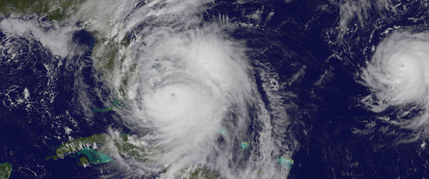
The dangers of seawater bursting into neighborhoods can be quite unexpected for those who have never experienced a hurricane of the immense power of Matthew.
Large wind-driven waves riding on top of a storm tide—the combined height of the astronomical tide and the storm surge—can wreak havoc on life and property. Especially if the waves and maximum storm surge arrive during the normal high tide period.

Storm tide is the combined water level from the astronomical tide and the storm surge height. Waves ride on top of the storm tide. Source: NOAA
Evaluating the potential magnitude and impacts of hurricane storm surges
- Look up the local time for high tide.
- Find out the projected timing for local storm surge for your area. (Select your local National Weather Service location at the bottom of the page.)
- Add the heights of #1 and #2 and compare with local topography for height above mean sea level.
- Know the hurricane category when it is predicted to affect your region. In general the higher wind speeds create larger storm surges. Damage increases by the cube of the wind speed.
- Consult the size of the hurricane. The larger the wind field the greater the storm surge. In 2012 Sandy was the largest Atlantic Hurricane to date with high winds extended over 900 miles that contributed to a major storm surge in New Jersey and New York.
- Check your location in relation to the hurricane track. The strongest winds typically are on the on the right side of the storm in relation to the forward motion of the hurricane in the northern hemisphere.
- Know your local geography and history of storm surges as the shape of each shoreline strongly dictates how large the storm surge will be.
Local storm surge projections can help plan for hurricanes
First and foremost, follow local authorities who have the latest local surge impacts information from NOAA. Consult the latest advisories for the particular storm such as those issued for Hurricane Matthew.
Based on the NOAA forecast issued at 12:00 p.m. EDT on October 6, it looks like Hurricane Matthew might reach the region of Mayport, Florida tide station during the rising tide on the evening of October 7 (see figure below).

Hurricane Matthew Quick Look from NOAA; posted 12:00 EDT 10/06/2016
The Union of Concerned Scientists report, The US Military on the Front Lines of Rising Seas, paints a picture of inundation under different categories of hurricanes for nearby Naval Station Mayport Florida.

Map depicts the depth of inundation for a Category 3 hurricane relative to current sea level (2012 baseline) at Naval Station Mayport and surrounding communities. Learn more about the methods used to produce this map in Florida.

Tide Station at the Bar Pilots Dock in Mayport Florida ahead of Hurricane Matthew from the National Ocean Service at NOAA. (http://bit.ly/2d6PTYb)
Hurricane Matthew has left in its wake devastation and tragic loss of life in Haiti. The uppermost priority is the flow of resources and information that can help those currently preparing for the storm and recovery from Hurricane Matthew.

