To help people visualize the trajectory of North Korea’s upcoming launch, I’ve created a file you can download to show the trajectory in Google Earth. Once Google Earth is installed on your computer, download this file, double-click on it, and the trajectory should load and appear in Google Earth.
The launch is an attempt to place a small satellite in orbit, and appears to be a repeat of last April’s unsuccessful launch. I calculated this trajectory using information about the missile stages, constrained by the locations of the announced launch hazard zones where the first two stages will splash down, and the fact that the launcher needs to boost the satellite to orbital velocity on a roughly horizontal trajectory.
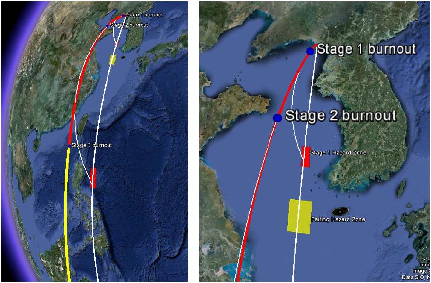
Shown in red on the map (Figure 1) is the path the launcher is intended to follow during the time its engines are burning. The long white curve below it is the ground track of the trajectory. Burnout of each stage is indicated by the blue dots on the trajectory. After stage 3 burnout the path of the orbiting satellite is shown in yellow; it is released at an altitude of just under 500 km. The map shows the first 1,500 seconds after launch—in reality the yellow line would continue as the satellite orbited the earth.
After the first two stages burn out, the empty stages separate from the rest of the launcher and fall into the water along the white curves shown on the map (Figure 2). The empty stages are intended to fall into the two red launch hazard zones that North Korea has announced. The third stage would separate from the satellite, but would also stay in orbit rather than fall immediately to earth. North Korea also announced the zone (yellow rectangle) where it expects the fairing to fall; the fairing covers the third stage and the satellite early in flight, and is dropped during second-stage burn to reduce the mass of the launcher.
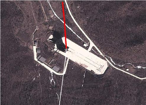
If you zoom in on the launch point, you’ll see that the trajectory starts on the launch pad at the Sohae site (Figure 3).
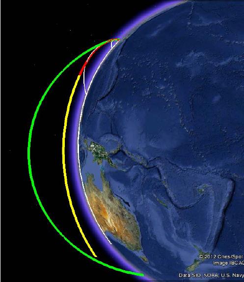
To be able to compare this satellite-launch trajectory with a typical 10,000-km ballistic missile trajectory, I’ve added an ICBM trajectory. Here’s how you can see that:
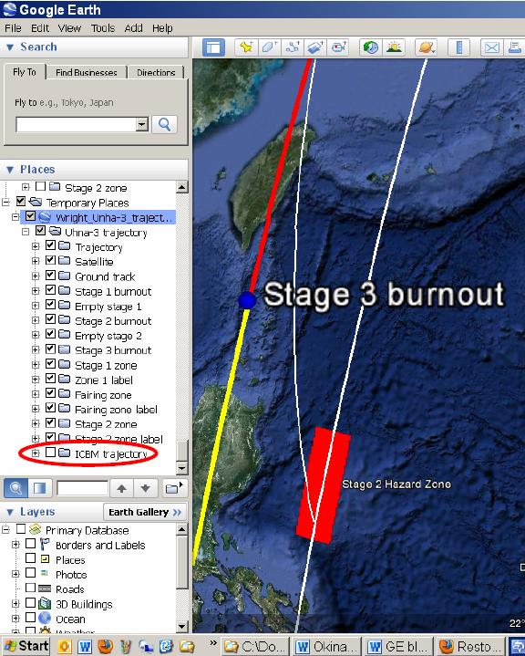
In the Places window on the left side of the Google Earth screen, look at the bottom of the list under “Temporary Places” (Figure 4). Click on the + sign beside “Unha-3 trajectory” to see the list of features you can turn on and off on the map. At the bottom of the list, click on the box beside “ICBM trajectory,” and it will appear in green on the map (Figure 5).
- Figure 5
This comparison shows that a typical ICBM would reach much higher altitude, and that the satellite launch trajectory turns over more quickly early in flight to place the satellite on this orbit.
When you exit from Google Earth it will ask if you want to save these trajectories in your “Places.” If you save them, they will be there the next time you start Google Earth. If you discard them, you can always load them again by clicking on the file given above.


