A new federal government satellite is now capturing the imagination of millions of Americans. I can guarantee that you’ve never seen an image of the Earth like the ones just released by NASA.
There have been many photographs taken of the Earth from space. Apollo 17 astronauts took the ubiquitous original “Blue Marble” photo in 1972. The Mars Rover took an incredible one in 2004. Then there’s this image created from satellite data in 2002.
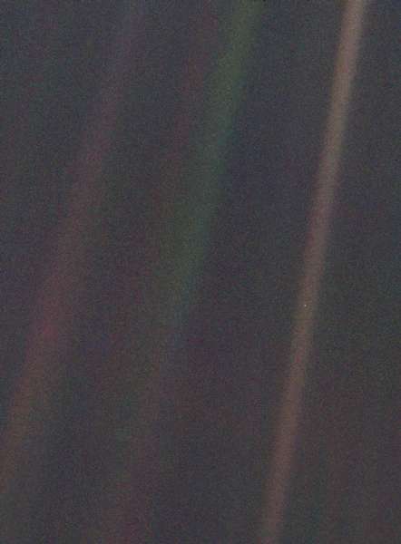
And then there is the Pale Blue Dot. In 1990, Voyager 1 headed out into space. It turned around and took a photo of Earth from a distance of nearly 4 billion miles. It appears as a tiny speck on a giant landscape. See it more than halfway down the brown stripe on the right (the stripes, in case you are wondering, are just glare from the sun):
Many were amazed by this visualization of the vastness of the universe, none more so than the great science communicator Carl Sagan. He made the Pale Blue Dot famous in a graduation speech and later in his book of the same name. Hear him read from it.
Sagan’s splendid contemplation of our place in the universe:
“Look again at that dot. That’s here. That’s home. That’s us. On it everyone you love, everyone you know, everyone you ever heard of, every human being who ever was, lived out their lives…on a mote of dust suspended in a sunbeam…In our obscurity, in all this vastness, there is no hint that help will come from elsewhere to save us from ourselves…To me, it underscores our responsibility to deal more kindly with one another, and to preserve and cherish the pale blue dot, the only home we’ve ever known.”
The other day on Frontline, UCS Nuclear Engineer Dave Lochbaum recalled that UCS co-founder Henry Kendall “used to say that you can’t have but one half of a boat sink,” that here on Earth, we are all in it together.
Fast forward two decades. In October 2011, NASA launched the Suomi National Polar-orbiting Partnership (Suomi NPP), an Earth-observation satellite that orbits the globe every 102 minutes at a distance of 512 miles.
Suomi NPP is the result of a collaboration among NASA, NOAA, and the Department of Defense. Here’s a great video from NASA that describes the NPP program.
On January 25, 2012, NASA released a composite image of the Earth created from photos from the satellite taken January 4 that NASA is calling the Blue Marble 2012. The image, which has been viewed more than three million times and counting, is absolutely stunning:
You’ll get a better view on NASA’s Flickr site. UPDATE: In a comment below, Norman Kurning, who created this image, tells us that it was put together from data collected during four separate orbits. The image is from a perspective of 1320 miles, or one third of the radius of the Earth.
Last week, NASA released another image comprised of information taken during six separate orbits by the satellite on January 23, this time showing Africa and parts of Asia:
View the high-resolution image. The perspective of each the second image is as if you were viewing the planet from 7,918 miles (one Earth diameter) above the surface. Learn more about how these images were created.
I can reproduce these images on this blog, just as you can print them out and frame them for your living room wall, because they were produced by the federal government. They’re royalty free. And they’re wonderful.
Of course, this is about far more than pretty pictures. The Suomi NPP is collecting data on long-term climate change and short-term weather conditions. NOAA uses the data from polar orbiting satellites for weather monitoring, and points out that polar-orbiting satellites helped predict the 2010 “Snowmageddon” East Coast blizzards several days in advance, enabling federal, state, and local governments to keep people safe.
NOAA tells us that the Suomi NPP can track everything from volcanic ash plumes to wildfires to sea ice to the ozone hole. According to NASA, the mission of the satellite is as follows:
“The five-instrument suite on Suomi NPP collects and distributes remotely sensed land, ocean, and atmospheric data to the meteorological and global Earth system science research communities. The mission will provide atmospheric and sea surface temperatures, humidity sounding, land and ocean biological productivity, cloud and aerosol properties, total/profile ozone measurements, and monitor changes in the Earth’s radiation budget.”
The data from Suomi NPP are already telling us more about how much energy is entering and exiting the Earth’s atmosphere, documenting how out of balance Earth has become due primarily to overloading our atmosphere with carbon.
This new government satellite helps remind me of our place in the cosmos–and how federal research initiatives are critical to helping us understand and better manage and care for the Earth we inhabit.


