
Yesterday, a mile-wide tornado that spent forty minutes on the ground ripped through Moore, Oklahoma. As of this writing, 51 people are dead (including twenty children) and more than 140 are injured (SEE UPDATE, BELOW). Almost immediately, this country began coming together to grieve and support the affected as it does during national tragedies. While it is clear that we have a long way to go in terms of tornado forecasting, investments in science and technology over the past three decades have significantly increased our understanding of these storms and our ability to minimize casualties.
Tornado forecasting from the 1980s to now
I remember being taught as a young child in Illinois in the early 1980s that a tornado watch was issued when scientists thought the conditions were favorable for a tornado to develop, and that a tornado warning was issued only when a funnel cloud was sighted or a tornado was detected. I remember being told to run into our basement if I heard a siren, as I might have precious few seconds.
Things have already changed. By coincidence, the American Meteorological Society president wrote a blog post on tornado forecasting just hours before the Oklahoma twister hit. He writes:
The nation’s upgrade to a Doppler (NEXRAD and Terminal Doppler-TDRW) radar system in the late 1980s/early 1990s ushered in advanced warnings that we now take for granted. As a graduate student at Florida State, I worked on some of the early NEXRAD tropical algorithms.
In the early 1990s, the average tornado warning lead time was 5 minutes. In 2010, it was 14 minutes. This increase in time to prepare and take cover is DIRECTLY related to more advanced technology and research enabled by U.S. tax dollars.
While my focus here is on radar, going from 5 to 14 minute lead time is also linked to improved modeling capacity, satellite capabilities, observations, training, and a generation of meteorologists (operational, broadcast, and private) that better understand how to communicate the threat.
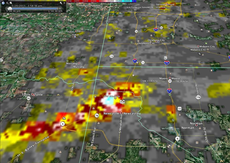
In Oklahoma, a tornado warning went into effect sixteen minutes before the tornado developed. BusinessWeek has a nice article about how the Moore emergency alert system works, and how investments in new technology undoubtedly saved lives. Those sixteen minutes allowed some teachers and elementary school students at Plaza Towers Elementary School to evacuate to a nearby church. The storm leveled the school. According to current news reports, while some younger kids tragically died at the school, many more older children were able to evacuate and are uninjured.
Current research can further improve lead times
But why can’t we do better, now? Simply put, we don’t have enough data, and the monitoring systems are not as robust as they could be. This requires investments. And some of that investment is happening right now. On May 15, several government agencies and universities launched a major field project to collect information that they hope will allow forecasters to give even more lead time. The research is funded by the National Science Foundation.
The American Red Cross began using NOAA data to plan disaster recovery right after the tornado passed through Moore. Better information helps people stay safe and recover more quickly.
Known as the Mesoscale Predictability Experiment (MPEX), the project is using planes and small instrument packages to collect data on atmospheric conditions in the upper atmosphere. Scientists believe we need to know much more about atmospheric conditions two to six miles above the surface of the earth prior to storms.
Each day, avoiding heavy air travel times, MPEX scientists will take off as early as 3:00 a.m. and fly at 40,000 feet for up to six hours. Potentially, this data will allow them to improve computer models to predict storms with more reliability. Learn more here.
Read more about the history and current state of tornado forecasting here, here, here, here, and here.
More reliable predictions would help the public make better choices when a storm is imminent, and give them more options to get to safety. After each siren, I became a little more blasé as a kid. Perhaps there was a tornado a few towns over, but nothing had happened to me. When I got to college, friends from rural Minnesota told of going outside during major storms and walking over to the lake to try to spot the funnel cloud.
Forecasters walk a tightrope. If they underestimate a storm’s potential, they are blamed for the resulting damage and loss of life. If they warn of too many storms that don’t materialize, people will take their projections less seriously and will fail to take sufficient precautions when a real storm strikes.
It’s important to point out that in a storm like yesterday’s, the only safe place to be was out of the way of the storm or in a basement or shelter. Those who did not have access to such a luxury were in big trouble. Better forecasting coupled with better emergency preparedness can help mitigate similar disasters in the future. Hopefully in a few years, we’ll be able to look back and think that sixteen minutes just wasn’t enough.
UPDATE, 10:00 a.m.: In some good news, the medical examiner has revised the death toll to 24, saying some people were counted twice. This number could rise as rescuers continue to comb through destroyed buildings.